The Legend tells you what the arrows í mean and how the terms "right" and "left" are used.
Pé
de Verde - Mato Inglęs - Baleia
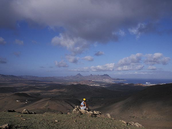
View from Mato Inglęs over Mindelo
| Duration | 2.5 h |
| Track | 1-4 |
| Orientation | 3 |
List of Tracks
and Classification
Monte Verde
Due to the respectable hight and the proximity to Monte Verde, to a constantly changing panorama view that finally covers all the island, this hike is one of the most beautiful ones on the island of Săo Vicente.
The track circels around the mountain range of Monte Verde in its south, brings you in touch with the village of Mato Inglęs, and after having passed by the little excentric compound of the former major of Săo Vicente, Dr. Onésimo Silveira into the absolute silence of an abondoned valley. The walk ends at the gigantic white beaches of Norte de Baía. From there you follow over the connected track 203 or eastward to Calhau oder westward to Baía das Gatas. So you have to add another hour to the expected duration.
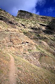
The trail, in part is a challenging mountain trail. So you need good mountain boots and long trousers resisting evetually thorn-bush.
Starting Point
is the crossing of roads at Pé de Verde [VERD01], where you may
get by Taxi from Mindelo in about 10 min. Having climbed the first slope
on paved road î a small pass [VERD02] is
reached and the view opens up to the east, over Calhau the
range of Madeiral and the pyramide of Pico de Vento and,
hopefully, over the neighbouring islands of Santa Luzia and Săo Nicolau.
At this pass we leave the paved road and take the small path crossing it.
At the first bifurcation of the trail we stay close to mountain
č and, at almost constant hight, î
come to a little road serving some private houses in the upper part
of Forca de
Baleia. Walking down the road, ę a
bifurcation close to the chicken farm of [MINDAV] exceeds a next
decision and we follow the branch winding up ę
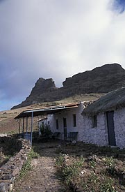
the valley to the huge house of č Dr. Onésimo
at Selada de Baleia. South of the surrounding wall we put our step
on the Pass [BALEIA] and certainly have short rest in order to enjoy the
view over the opening valley of
Baleia and the continuity of the path. First we go in direction of the
top of Monte Verde é
and get as close as possible to its southern slope. Only after the second
crossing ribeira [BALE02] we start the descent on a ridge č
showing the way down to some abandoned farmhouses. [BALE04] From
there we follow the goat track and ground of the valley until finding
ourselves at the beach. [BALE05]
Connected track:
Via
track
![]() it takes a little more than an hour î
to reach Calhau or alittle less than an hour to ë
Baía das Gatas.
it takes a little more than an hour î
to reach Calhau or alittle less than an hour to ë
Baía das Gatas.