|
The
Legend
tells you what the arrows í mean and how the terms
"right" and "left" are used.
|
Cabeço dos Tarrafes - Morro Negro - Porto Ferreira - Fundo das Figueiras |
||||||||||
|
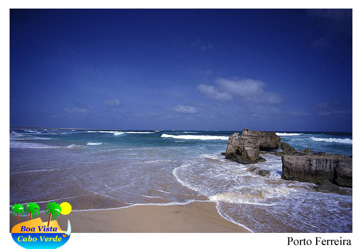
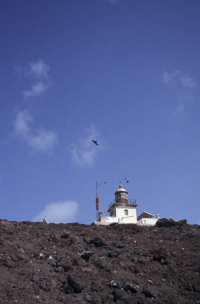
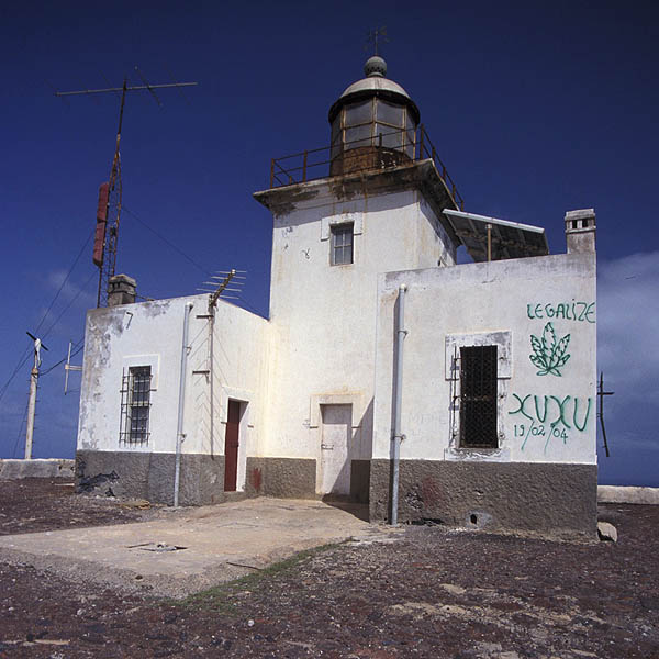
To the smugglers harbours of the East Coast, we have to leave the densly populated agricultural valley of RŞ de Norte climb to the lighthouse tower on top of Morro Negro, where the birds play in the upstream winds of a splendid panorama view. Goat tracks take us futher to the wild coast of sandy beaches and the impressive rocks at Praia Mosquito. From the former smugglers harbour of Porto Ferreira, an abandoned road connects back to civilization at Fundo das Figueiras.
5 liters of drinking water per person, solid shoes, sun
protection, our map, a compass and eventually binoculars for bird-watching
are strongly recommended. When temperatures rise, walking times and water
consumption go up as well!
Starting Point The panorama view is a good reason for a longer rest. Bird-watchers, keeping quiet in the shadow of the tower, get very close to sea birds and desert ravens playing in the upstream winds from the North-East. To continue, there are two ways possible:
Before éreaching the very northern tip of Tabuleiro [MNEG14], a little trail descentsě from the sholder down to the ground of tiny RŞ Preta, follows the groundline of the slope for about 100 m é before heading out ě into the plain of gravel and sands, descending smoothly to the shore. Following the ridge éof the limestone plateau, some wonderful rocks, laying out in the whitewaters, challenge every photographer. A camera, wide-angle lens, polarization filter, tripod and an ambitioned photographer can show what they are able to produce - and wait for hours for the right moment! Strolling the beach further North é after half an hour the prominent peninsula of Porto Ferreira marks the endpoint. The former access road is still visible ç from far away but mainly covered with sand - and therefore easily lost when trying to follow it. Nevertheless, navigation is no problem, as ist is always redetected in a distance. Having said good bye to the eastern coast at the pass of Selada Ferreira [PFERD05] the visitors ë find back to the soft valley of RŞ do Norte.
In Fundo das Figueiras, smaller shops at the
square next to the Church [FIGU02] offer drinks from the fridge!
|