|
The
Legend
tells you what the arrows í mean and how the terms
"right" and "left" are used. |
Cabeįo dos Tarafes - Odjo d' Mar - Fundo das Figueiras |
|||||||||
|
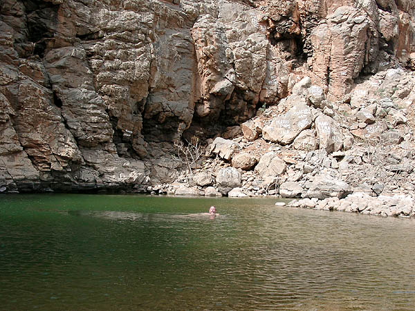
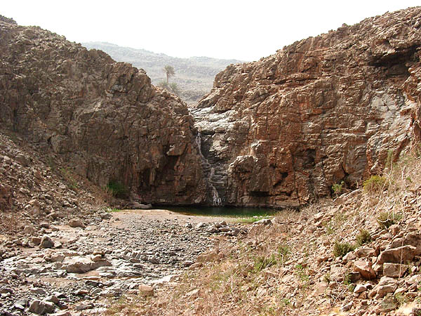
An emerald hides in the rocky heart of the island by the name of Odjo d' Mar. The creole word means sweat water lake - unique on the arquipelago. Divers have tried to discover all its secrets and tell us that it is 3.70 m deep, while the diamond cave deep under with its magic dragons and pink sharks still resisted dicovery - just gravel. Like in any good tale, it is difficult to get hold of the precious stones. In this case, you don't need a Abrakadabra but 2 Liters of drinking water, mountain boots, sun protection, map and a compass to succeed. A swim suit and a torch (better two) identify the experiened adventure girls and boys. Starting Point is the little village of Cabeįo dos Tarafes, better to say the very first houses of the village when arriving from the North. Some isolated houses are found on the shoulder of the western slope and we take their access paths į . [OIDA01] Only a few meters later a car track starts [OIDA02] to accompany a former water line man į upphill. Some 20 minutes later, on the Lomba de Palha, a little dustroad turns in. [OIDA03] Continuing upphill í the dustroad ends in a quarry. [OIDA04] Now, there are two ways to access the fabulous Odjo d'Mar.
Version 1 for the silent majority:
Version 2 for Harry Potter and friends:
|
|||||||||
|
* In our map still called "RŠ do Olho do Mar"
in the Portuguese of Military Cartographers of 1971. Will change in the
following editions. updated 28/12/2005 |